Saturday, July 16, 2022
Saturday, January 29, 2022
Hiking Red Bird Canyon
I've been meaning to hike the entirety of Red Bird Canyon for a year now. Turns out to be a bit of a challenge. 5 miles one way, from the top at 3300ft to 750ft at the bottom. Plus, its so nice down on the river that you should really spend a significant amount of time down there. I merely sat for 10 minutes on a rock and had the standard European hiking fare of wine and cheese, but you should really bring a nicer spread and take a couple hours.
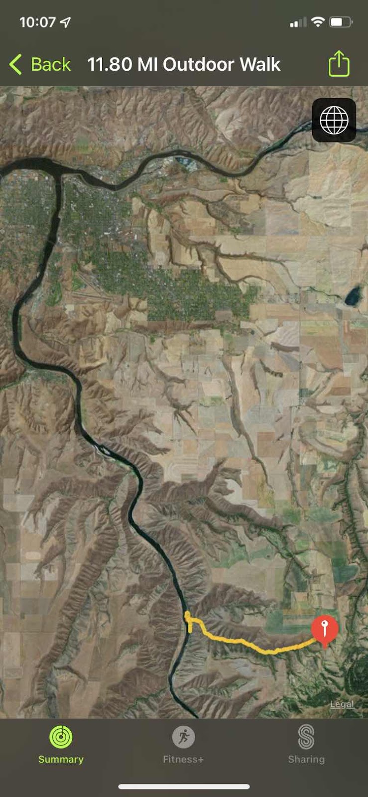
Red Bird is 20 miles or so south of Lewiston.

I would not normally consider this "Hell's Canyon", but I think its easiest to judge that anything south of Hell's Gate Rock (It really doesn't have a name, but it should) to be part of Hells Canyon. That includes Asotin, by this definition.

BTW, this is Hells Gate Rock. You drive right under it (it's at least 10 stories high) as you drive from Clarkston to Asotin. Hells Canyon is legendary from the time of the earliest explorers of what became the western United States. It is the deepest canyon in the US, and the land that surrounds it rises 7000 to 8000 feet above the river at points. The canyon walls descend at a typical angle of 45 degrees and a many points plunge straight down into the river such that no land navigation can occur on this river without hiking up sometimes as much as a mile. This is why it was named Hells Canyon. To this day there are no roads in at least 50 miles of the canyon, (that's a bad guess, I'd say it's more like 150 miles).
The only way to get in to most of the canyon is to either jet boat in or hike.

Me near the top. Still fresh. Got all my layers on still because it started out 28 degrees with a biting SW wind.

The trail is a double track. Looking down canyon.

The trail is a double track. Looking down canyon.
You start on top of the prairie and as you go down, you can see the tops, but sometimes the canyon itself obscures view of the top.

Evidence of human habitation about 3 miles down.

Basalt everywhere, often columnar.

Last straightaway before the bottom, about 1 mile up from the river. I took this picture because of the nearly vertical game trail that goes straight up just left of center. I need to climb that trail some day.

Last straightaway before the bottom, about 1 mile up from the river. I took this picture because of the nearly vertical game trail that goes straight up just left of center. I need to climb that trail some day.
Very rarely there would be a nice "meadow" that actually received sunshine. I hike this at the end of January, so the sun was low enough to never hit large swaths of the canyon. Lots of snow lying about.

Lunch at the river. Looking south to the sun. Grand Ronde River that way.


Lunch at the river. Looking south to the sun. Grand Ronde River that way.
The north end of the effluvium from the canyon has a nice soft sandy beach. A much easier way to get here would be via jet boat from Lewiston. I'll explain later what a jet boat is.
Ok. It’s later. Here’s a short vid to give you an idea of how big the Snake River breaks are.
Oh, here’s a jet boat. It’s noisy, with a big engine, but you don’t really have an idea what they can do til you see them go thru rapids.
This is what they can do.
Plus, the jet impeller is above the hull of the boat, so they can run in almost now water at all.
Foundation of a pioneer house at the mouth of Red Bird creek. The only road here is on the other side of the river.
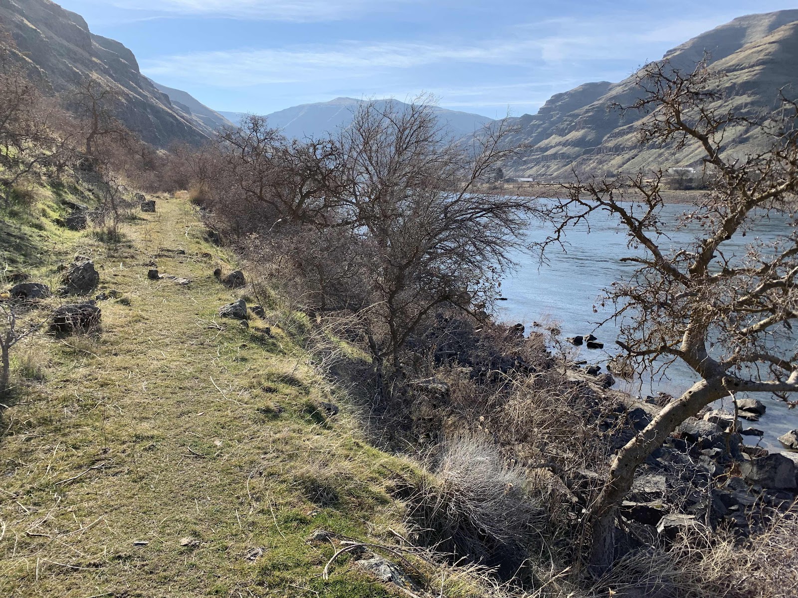
Once on the river, you can follow the "Upriver Trail" south, I'd say at least 30 miles. It seems like it used to be a hand-made wagon road, but rocks falling from the hills and trees that are now at least 50 years old have made this thoroughfare foot traffic (and maybe horses) only.
Looking north, over my shoulder you can see the homes and the road on the west side of the Snake River.

Myth of the mountain man. 28 degrees with a wind chill to 20, a box of wine, a 2600 vertical climb, and only two thin layers of cotton. Plenty warm for the Idaho hiker.
Subscribe to:
Posts (Atom)